Peter A. Knoop, LSA Technology Services

Contact Peter at knoop@umich.edu.

Dearborn hosts GIS Day Wednesday, Nov. 14

  GIS Day is a global event celebrating the use of Geographic Information Systems (GIS). It provides an international forum for users of GIS technology to demonstrate real-world applications that are making a difference in our society. At the University of Michigan you can join the celebration by attending UM-Dearborn’s GIS Day Event (8:30 a.m.–4:30 p.m., Wednesday, November 14.) Activities will… Read More »

Get high-resolution aerial imagery from Nearmap US

Ever needed higher-resolution aerial imagery than Google or ArcGIS basemaps offer? Or, more frequent historical imagery? Nearmap, for which the Library recently renewed university-wide access, meets both those goals for developed areas of the U.S. (Rural areas are not covered by this service.) Nearmap imagery has a resolution of less than 7.5cm (or <3-inches), as compared to the… Read More »

OpenStreetMap conference Oct. 5-7

State of the Map US 2018, the OpenStreetMap user conference, will be held in Detroit, MI on 5-7 October this year! OpenStreetMap is the wikipedia of maps, an open, collaboratively edited map used for everything from international disaster response to autonomous vehicles. You can see the data in Apple Maps, Snapchat, Uber, Lyft, and dozens of other tools we use every day. State of the Map is particularly… Read More »

LSA IT honored for special achievement in GIS

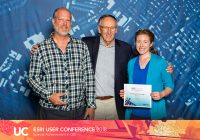
Esri, the global leader in spatial analytics, presented LSA IT with Esri’s Special Achievement in GIS (SAG) Award on July 11 at the annual Esri User Conference. Selected from over 300,000 eligible candidates, LSA IT received the award for its innovative application of mapping, data analytics, and thought leadership in higher-education research and teaching. The SAG Awards are meant… Read More »

U-M recognized as leader in GIS by Esri

Earlier this year U-M was invited to participate in the informal Esri Development Center (EDC) program. We join a small number of universities recognized as leaders in GIS teaching and research. While the EDC program was initially conceived with a focus on development in the traditional sense—coding and programming of geographic information system (GIS) solutions—U-M was identified as… Read More »

Archaeology AR/VR/3D technology showcase

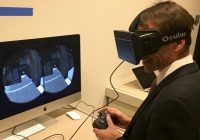
Experience how archaeologists use augmented reality (AR), virtual reality (VR), and 3D thru hands-on exhibits highlighting web technologies, Oculus Rift, Hololens, and 3D displays. This event is part of “Into the Third Century: The Past, Present, and Future of Michigan’s Archaeological Museums”, a graduate and undergraduate student symposium sponsored by the Collaborative Archaeology Workgroup, in conjunction with the… Read More »

Annual Esri academic site license renewed

March is the month when U-M’s Esri academic site license renews each year. This includes licensing for ArcGIS for Desktop, ArcGIS Pro, ArcGIS Online, CityEngine, and a wide variety of other Esri products. The university-wide concurrent license server has already been updated, however, users relying on annual single-use licensing will need to re-authorize their installations by the end of the… Read More »