
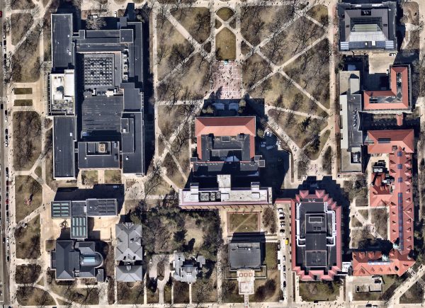
Nearmap aerial imagery of the Diag (click to view full-resolution.)
Ever needed higher-resolution aerial imagery than Google or ArcGIS basemaps offer? Or, more frequent historical imagery? Nearmap, for which the Library recently renewed university-wide access, meets both those goals for developed areas of the U.S. (Rural areas are not covered by this service.)
Nearmap imagery has a resolution of less than 7.5cm (or <3-inches), as compared to the ~33cm (or ~1-foot) resolution of typical imagery sources. And, coverage has been repeated every three to six months since 2014; more frequently in more urban areas. Also, at least one flight a year is timed for a leaf-off period to minimize vegetation obscuring the ground.
For example, coverage of the Ann Arbor area starts in October 2014, and repeat flights have occurred approximately every six-months. The leaf-off Nearmap imagery of Angell Hall and the Diag in the accompanying photo is from March 2018 (view full-resolution image), while the most recent coverage of Ann Arbor comes from July 2018.
Nearmap imagery is available directly within the ArcGIS platform as an Imagery Layer. Join the Nearmap US Photomaps ArcGIS Online group (login with your UMICH account) to access the full complement of Nearmap US Photomaps from any of the web, mobile, or desktop components of ArcGIS.
You can also request access to the data via the Nearmap website, from which you can download imagery (limited to 20MB). Request access by emailing [email protected] with a brief description of your need.
If Nearmap isn’t quite what you need, keep in mind that you also have access to over 300 other modern and historical imagery layers through the university’s subscription to Esri’s Living Atlas. And, check out the Library’s Aerial Photographs and Imagery Research Guide for even more suggested sources.